Difficulty: v4a3III
Highest rappel: 85 meter
Number of rappels: 11
Needed cars: 1 or 2
Approach: 20 or 60 minutes
In the canyon: 4 hours
Return: 10 minutes
Overall time: 6 hours
Altitude parking: 165 meter
Altitude entry: 400 meter
Difference in height: 235 meter
Length: 500 meter
The Ribeira das Furnas canyon in Ribeira Brava, Madeira
is a small hidden gem with a gigantic waterfall where abseil point follows abseil point. The gorge was
first descended in 2005 by a group of Spanish cave explorers, of whose anchor points only rudimentary
remains were left when we visited the gorge the first time. Completely new equipment was therefore
essential. Casa Vento carried this out in January 2023. Stainless steel U-shaped anchors
are now available at all abseiling points, some with a solid chain stand.
If you know how to deal with great abseiling heights with intermediate anchors, you can look forward
to an action-packed canyoning tour after a challenging approach. Our topo
provides you with the necessary information.
The canyon usually only carries a good amount of water in winter or after long periods of rainfall,
and the flow is clearly visible from the road below.
Unfortunately, there is some garbage in the canyon from the village above, and we will look into
cleaning it up on future visits.
The download version is characterized by complete GPS data.
Michael is at your disposal as a canyoningguide for this and all other tours in
Madeira. Casa Vento also offers equipment rental.
We provide the following service:
Guiding of almost all canyons in Madeira
Trilingual tours (German, English, French)
Photo and video service
Rental of sports equipment
Transfer trips to the canyons
Catering at Casa Vento
Accommodation in Ribeira Brava
Welcome to Casa Vento in Ribeira Brava!
Share page with other canyonists:
Here is the important information for canyoning:
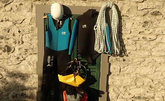
We recommend the following equipment for the Ribeira das Furnas gorge:
Wetsuit, 5mm with hood
Neoprene socks
Mountain sports helmet
Canyoning harness with two lanyards
Abseiling eight
Several carabiners
Rescue equipment: ascender, knife etc.
Canyoning shoes
Canyoning backpack
Waterproof barrel
At least 2 x 25 and 2 x 60 meters of rope
60 meter emergency rope
First aid kit
Spare material
Swimsuit and towel
Sufficient snacks
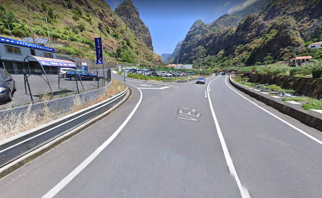
Drive out of Ribeira Brava on the VE 4 towards Sao Vicente. A good 200 meters after the tunnel
at the sports field, turn left at the car dealer in the direction of Meia Legua.
Coming from Sao Vicente on the VE 4, turn right shortly before Ribeira Brava at the second
possibility to Meia Legua (the first road is closed).
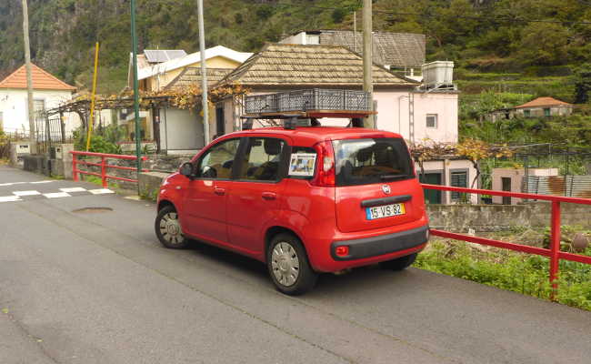
Park as close to the small white church as possible.
GPS data of the parking lot:
32.xxxxxx
-17.xxxxxx
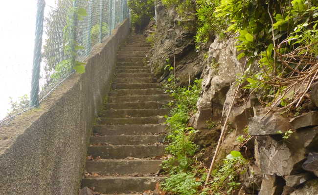
A few meters away, between house number 19 and a messy car repair shop, a narrow stairway leads
steeply upwards. Be careful, rocks often fall here.
GPS data of the start of the path:
32,xxxxxx
-17,xxxxxx
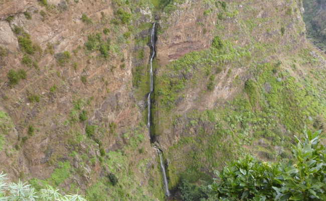
During the ascent, you can admire the impressive waterfall and the water level.
Follow the path until it becomes flatter. You now pass a section along a light brown rock face.
Shortly afterwards, a hard-to-see path leads down through the agricultural terraces towards the
canyon. It is at the height of a light pole and a power pole.
GPS data for the start of the path:
32,xxxxxx
-17,xxxxxx
The rest of the description at "To the gorge".
Further up, the main path leads along a bridge over the watercourse; it is also possible to enter here,
but not recommended. The equipment is rudimentary and the gorge is extremely overgrown in places,
making progress very difficult. In addition, the proximity to civilization with waste problems
is quite obvious.
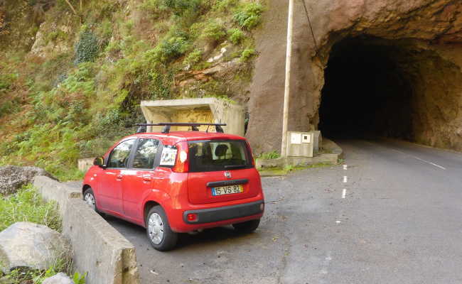
The Ribeira das Furnas canyon is also possible with shuttle, but the drive to the top takes just
under 30 minutes, so you don't save any time, quite the opposite. One option would be to drive to
the upper parking lot and have a participant pick up the car after the canyoning tour without
equipment. Park directly after the dark tunnel on the right-hand side.
GPS data of the upper parking lot:
32,xxxxxx
-17,xxxxxx
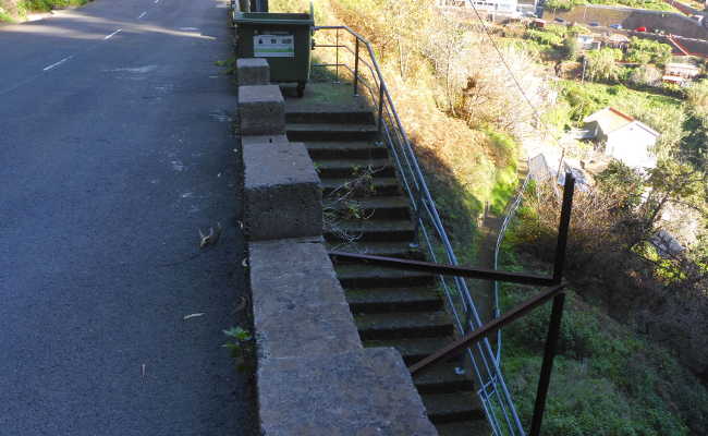
The approach from above starts at the steep steps next to the garbage can, 30 meters after the
upper parking lot. After a few minutes, keep right at the first junction, making sure that you
stay on the public path. Follow this southwise until the end of the development. A small path
through the agricultural terraces starts between a light pole at the top right and a power line
pole at the bottom left.
GPS data of the start of the path:
32,xxxxxx
-17,xxxxxx
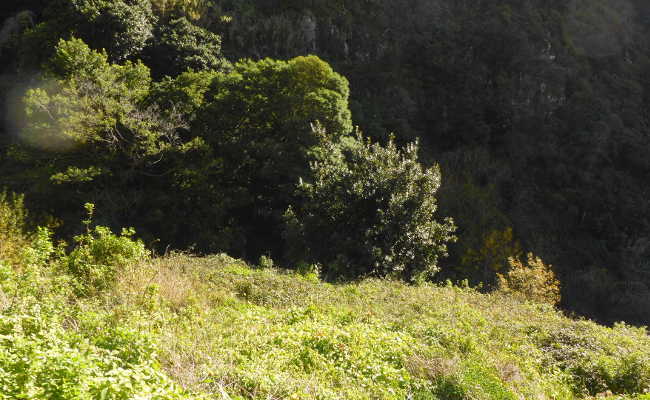
Follow the sometimes hard-to-see paths towards the gorge. Aim for these two striking trees that
mark the start of the canyoning.
GPS data of the entrance:
32,xxxxxx
-17,xxxxxx
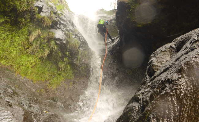
After three easy abseils, you will find yourself in the heart of the narrow gorge.
From here it gets exciting.
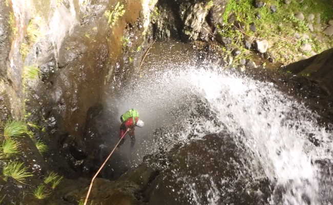
The most spectacular waterfall is this narrow canal, the route runs directly through the water.
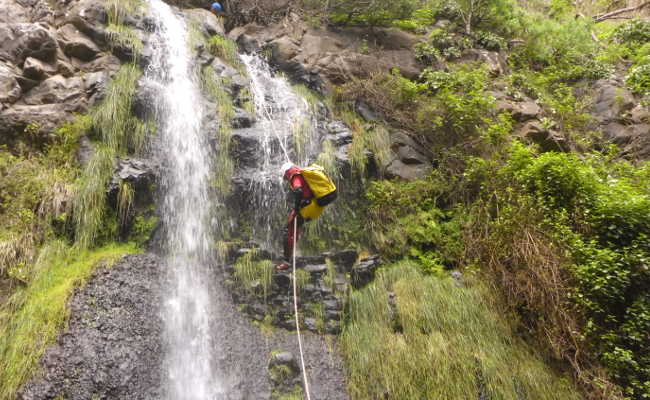
The last waterfall is a good 20 meters high. Be careful with the natural stone wall in the middle!
This is followed by a few downclimbing sections, some of which are overgrown with bamboo.
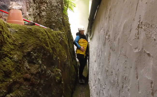
You are now clearly approaching the houses. Shortly before the church, climb the concrete wall on
the right bank, at the end of which you can squeeze past the church through a narrow passage.
You have now reached the car.
GPS data of the exit:
32,xxxxxx
-17,xxxxxx