Difficulty: v3a3II
Highest rappel: 20 meter
Number of rappels: 13
Needed cars: 1
Approach: 60 minutes
In the canyon: 3 hours
Return: 75 minutes
Overall time: 6 hours
Altitude parking: 1000 meter
Altitude entry: 1020 meter
Difference in height: 250 meter
Length: 1200 meter
The Casa Vento team has descended and documented many canyons in
Madeira over the past few months. We have created a topo
accordingly and are publishing it here on our website. Here you can find the description
of the Ribeira da Agua Negra inferior in Calheta, very close
to the 25 Fontes. The description is based on our own inspection and is therefore
reliable except for unforeseeable changes. Above the gorge, the water is diverted from a levada,
but you should not enter the canyon after or during heavy rainfall or other storms. Traces of
flooding in the course of the descent speak for themselves. There is also a small landslide in
the last part of the canyon. This happens from time to time in Madeira, sometimes destroying
anchoring points. As the equipment in the canyon is very old and dubious in places, you should
always have emergency pitons with you. There have also been reports of anchors being stolen.
In the download version you will find the complete GPS data.
We are your contact when it comes to canyoning on the island of flowers.
We provide the complete service:
Canyoning in the mentioned gorges
Trilingual guide with 20 years of experience
Photo and video service for you
Equipment rental for canyoning
Transfers to the tours and shuttle service
Accommodation in an apartment, single or double room
A warm welcome to Casa Vento in Ribeira Brava!
Share this page with friends:
Now to the important information for your canyoning tour:
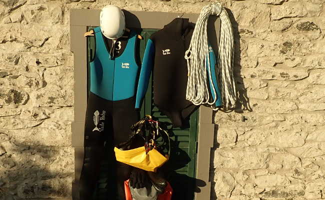
As with any canyoning tour, you will of course need the usual equipment for the Ribeira da Agua
Negra inferior:
Wetsuit, two-piece, 5mm with hood
Neoprene socks
Mountain sports helmet
Canyoning harness with double lanyard
Abseiling device
Sufficient carabiners
Rescue equipment such as ascenders etc.
Canyoning shoes
Canyoning rucksack
Waterproof screw barrel
At least 2 x 20 meters of rope
20 meter emergency rope
First aid kit
Spare abseiling device
Emergency bolting set
Swimsuit and towel
Food and drink
Headlamp
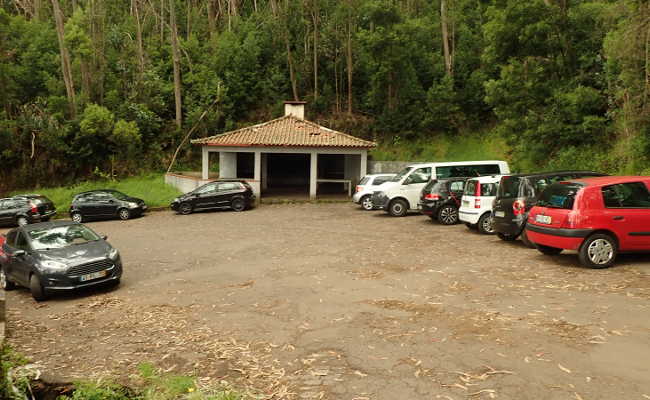
Coming from the east, take the ER 101 on the Paul da Serra plateau towards the 25 Fontes parking
lot. Pass this and about 800 meters later take a turn-off to the left towards Calheta.
GPS data of the junction:
32,xxxxxx
-17,xxxxxx
Coming from Porto Moniz, the turn-off is easy to miss. If you are at the parking lot
25 Fontes, you have driven too far.
Follow this paved road (ER 211) downhill for a good 2.5 km until you reach a barbecue hut.
You can park here.
GPS data of the parking lot:
32,xxxxxx
-17,xxxxxx
There are other parking / access options, this is the most convenient.
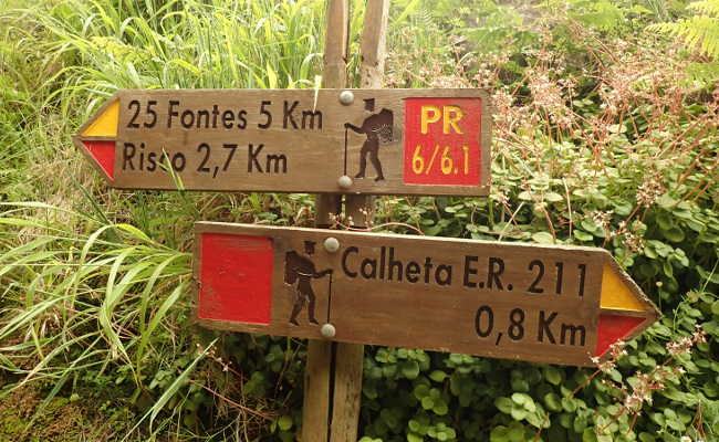
Opposite the barbecue hut, a wide forest road starts with a sign for the hiking trails in the
area. Follow this forest track until you reach a forest worker's house. A long, dark tunnel
begins here, for which you will need a headlamp. There is a sign "25 Fontes" in front of the tunnel.
GPS data of the tunnel entrance:
32,xxxxxx
-17,xxxxxx
Cross the tunnel and simply follow the path along the levada without branching off. To do
this, follow the bend to the left shortly after the tunnel. The path is at ground level for a long time.
GPS data of the tunnel exit:
32,xxxxxx
-17,xxxxxx
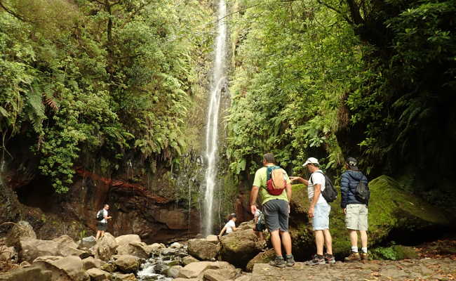
In a hollow, you cross a bridge over the Ribeira Grande. Sometimes a powerful waterfall
rushes into the gorge here.
GPS data for the bridge:
32,xxxxxx
-17,xxxxxx
Continue along the levada, after a good 400 meters a path branches off to the right at the top.
GPS data of the junction:
32,xxxxxx
-17,xxxxxx
Depending on the condition of the levada path, this is obligatory. It leads over the mountain
instead of around it. After a few minutes you meet the levada again, which you follow to the right.
GPS data of the crossroads:
32,xxxxxx
-17,xxxxxx
Shortly afterwards you will reach the 25 Fontes.
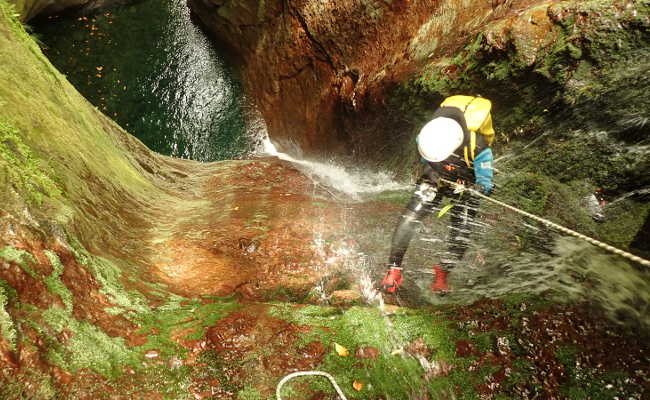
Opposite, in a mostly dry riverbed, is the entrance under a bridge.
GPS data of the entrance:
32,xxxxxx
-17,xxxxxx
The water in the first pool is very cold, so be sure to put on your wetsuit, even if there is
no water flowing. After two abseiling points, there is a 400-metre-long and quite arduous walking
section over rocks and in places through undergrowth. Spiced up only by a 4 meter downclimb.
Finally the fun begins and the canyon narrows. After a total of 6 abseiling points, the
Ribeira dos Cedros suddenly flows in behind a corner. As the Levada da Roche Vermelha drains
most of the water, this normally has no effect on your tour.
There is also the possibility of an emergency exit here. To do this, follow the levada through
a short tunnel to the left in the direction of the flow and follow it to a bridge (see return).
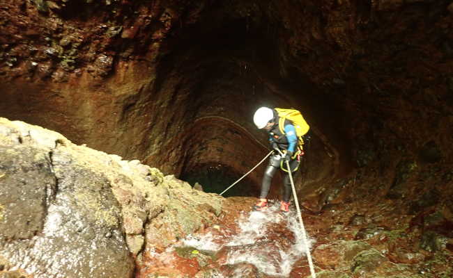
The gorge narrows again very nicely and is followed by great abseiling sections, a tricky
jump and a fast slide. Be careful, the depth of the pool varies from year to year! It becomes
more open again and a long rope railing takes you to the last abseil, which daredevils
jump from the right bank. The jump is a good 12 meters high. Be sure to check the
pool beforehand! Alternatively, you can abseil down to a good 2 meters before the pool and
jump the rest. After another 20 meters of swimming, you reach open terrain and the Ribeira
Grande flows in from the left. This is exactly where the exit begins.
GPS data of this point:
32,xxxxxx
-17,xxxxxx
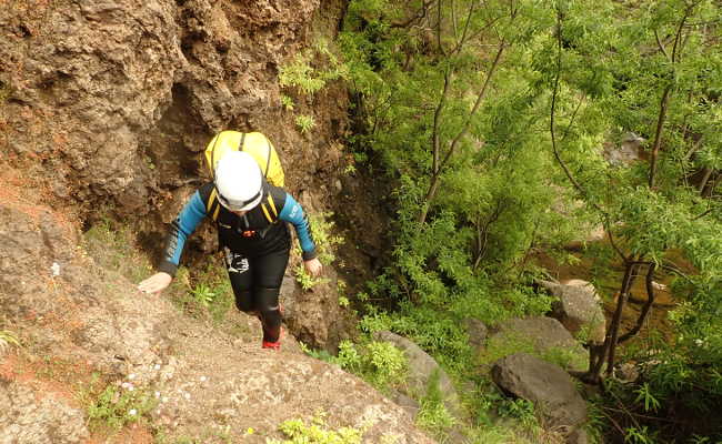
The navigation adventure begins. The ascent is steep and difficult to see in places. Right
between the two rivers is a characteristic rocky ridge of brown, conglomerate-like rock.
Climb up this and at the end you will find a narrow path through the forest that leads to
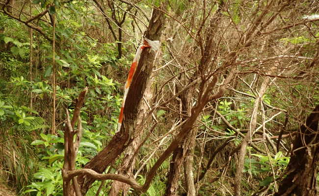
a hidden little stone hut. Short pieces of fluttering tape are tied to some of the
trees to mark the way. You reach the levada after a good 15-minute climb.
GPS data of this point:
32,xxxxxx
-17,xxxxxx
Follow the levada to the right in the direction of flow. Continue down to a fork to the right.
In 30 meters it leads to a metal bridge, which you cross.
GPS data of the junction:
32,xxxxxx
-17,xxxxxx
On the other side, follow the levada again for a few meters. Now a path branches off sharply
to the left and up.
GPS data of this point:
32,xxxxxx
-17,xxxxxx
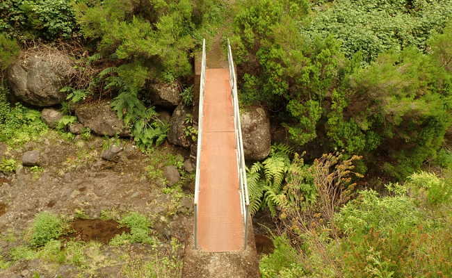
Follow this path through the intersection. It is partly overgrown. The ascent is steep and
exposed in places, leading back to Levada 25 Fontes in a good 20 minutes.
GPS data of the junction:
32,xxxxxx
-17,xxxxxx
Turn right until you reach the well-known access tunnel. Cross it and follow the forest road
to the parking lot.
An exhausting day with great experiences lies behind you.
Congratulations!