Difficulty: v5a3II
Highest rappel: 90 meter
Number of rappels: 4
Needed cars: 1
Approach: 20 minutes
In the canyon: 1 hour
Return: 5 minutes
Overall time: 3 hours
Altitude parking: 25 meter
Altitude entry: 140 meter
Difference in height: 115 meter
Length: 150 meter
Michael from Casa Vento has created a topo for many canyons in Madeira
and would like to share his knowledge with you. Here you can find the Agua da Alto
canyon in Sao Vicente. The description is based on a personal ascent and is therefore
reliable except for unforeseeable changes. In order to find good conditions, you should not go
canyoning after heavy rainfall or thunderstorms. There are often landslides in Madeira, which
can change a canyon or destroy or bury anchoring points. The Agua da Alto is characterized by
fast-growing, sometimes thorny vegetation, especially on the approach and in the area of the first
abseil. A machete or garden scissors and leather gloves can therefore do no harm. A high degree
of wayfinding is also required, as the approach path is barely recognizable in many places.
In the (german) download versions you will find the complete GPS data and two maps.
I am your experienced guide for canyoning on the island of flowers.
Casa Vento provides the complete service:
Guiding of the presented canyon from two persons
Trilingual CIC Canyon Guide with years of experience
Photo and video service for your tour
Rental of the complete equipment
Transfers to the canyons and parking service
Catering: Breakfast, packed lunch, dinner
Accommodation in a room or apartment in Ribeira Brava
A warm welcome to Casa Vento in Ribeira Brava!
Share page with other canyonists:
Here is the important information for the canyoning tour:
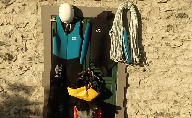
As with any canyoning tour, you will also need the usual equipment for the Agua da Alto waterfall:
Wetsuit, two-piece, 5mm with hood
Neoprene socks
Mountain sports helmet
Canyoning harness with double lanyard
Descender
Sufficient number of carabiners
Rescue equipment such as ascenders etc.
Canyoning shoes
Canyoning backpack
Waterproof barrel
At least 2 x 55 meters of rope
55 meter rescue rope
First aid kit
Spare descender
Bolting kit
Swimsuit and towel
Food, Drink
Garden scissors, leather gloves
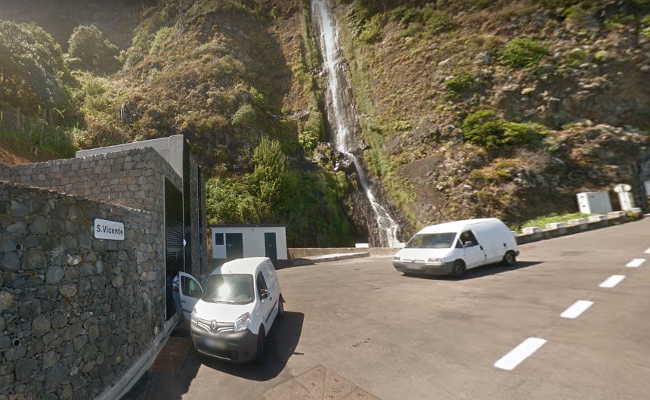
In Sao Vicente, drive towards Seixal on the VE 2, passing through the Tunnel da Terra Cha,
which takes you towards the coast. Just before the Agua de Alto tunnel, there is a parking space
for three to four cars on the left next to a transformer house.
Coming from Porto Moniz, drive through the six tunnels Seixal, Lugar, Joao Delgado, Ladeira da Vinha,
Ribeira do Inferno and Agua de Alto. Immediately after the tunnel, the above-mentioned parking lot
awaits you on the right.
GPS data of the parking lot:
32,xxxxxx
-17,xxxxxx
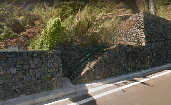
Make sure you put on your harness and helmet before you start. 50 meters to the east you will
find a wide staircase that leads into the slope, but ends quite quickly.
GPS data of the stairs:
32,xxxxxx
-17,xxxxxx
A very poorly visible path begins here, with individual steps made of natural stone under the
leaves and grass in places. The path winds steeply and exposedly up the slope in several serpentines.
Finally, after a good 15 minutes, you come to a water pipe, where a thin steel cable anchored in
the rock face does not inspire much confidence. This rope railing leads you to the right towards
the canyon. At the end, turn left towards the center of the island and after a few meters you
will see the entrance on the right.
GPS data of the entrance:
32,xxxxxx
-17,xxxxxx
Here you may come across some thorny bushes.
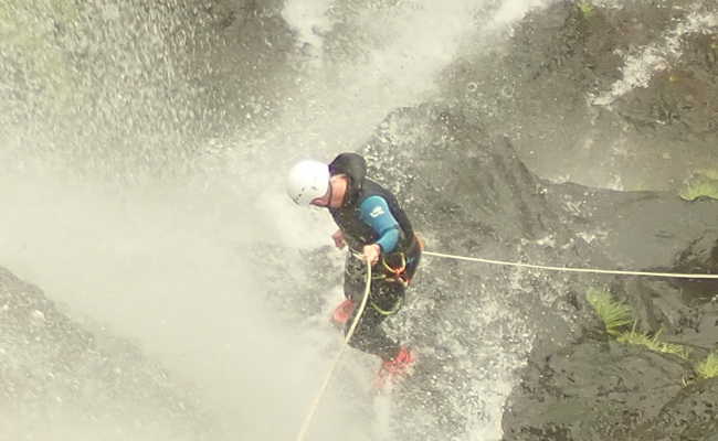
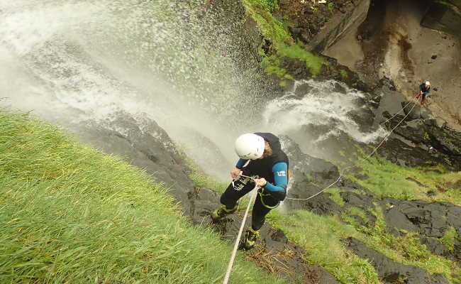
First, two short but slippery abseiling passages await you, which are best negotiated on the right bank. The first abseiling point is on the left bank at the large boulder that dominates the waterfall. You will also encounter thorn bushes here. Cross a short pool and you will find yourself at a breathtaking waterfall about 90 meters high. The easiest way to proceed is to use the rope railing and then abseil in three sections: 6 meters, 35 meters and 50 meters. For larger groups, it is advisable to carry appropriate ropes, as the last stand is extremely uncomfortable and has no standing surface. There is room for a maximum of two people here. Don't forget to bring webbings! The entire tour takes about an hour with a well-coordinated team.
The way back is self-explanatory, you can see your car from the rope railing. All you have to
do is climb out of the last pool to the left. Alternatively, go under the road and then turn right.
After 50 meters you will come to a staircase to the road. Beware of the very high risk of falling
rocks in the lower basin!
GPS data of the basin:
32,xxxxxx
-17,xxxxxx